Solutions
Solutions
Precision Agriculture
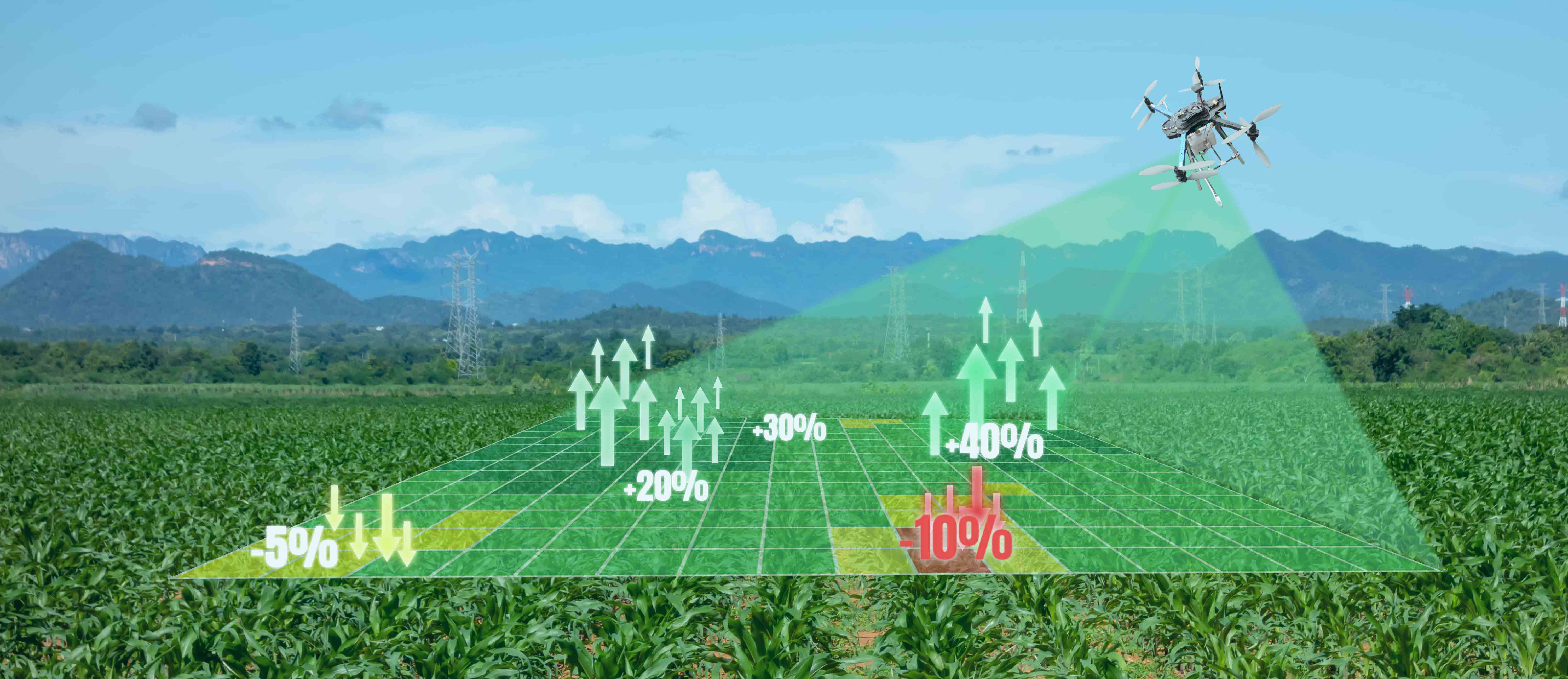
Agriculture is the backbone of human civilization and the lifeblood of India. It must expand at a rapid rate to keep up with the growing population. Unfortunately, farmers in India face several challenges like declining yields, pest infestations, water management and other issues.
Magic Mynas drones aid in precision agriculture which empowers them and enhances the income of the farmers.
Our Kisan Drones superpower farmers through:
Healthcare & Emergency Responses
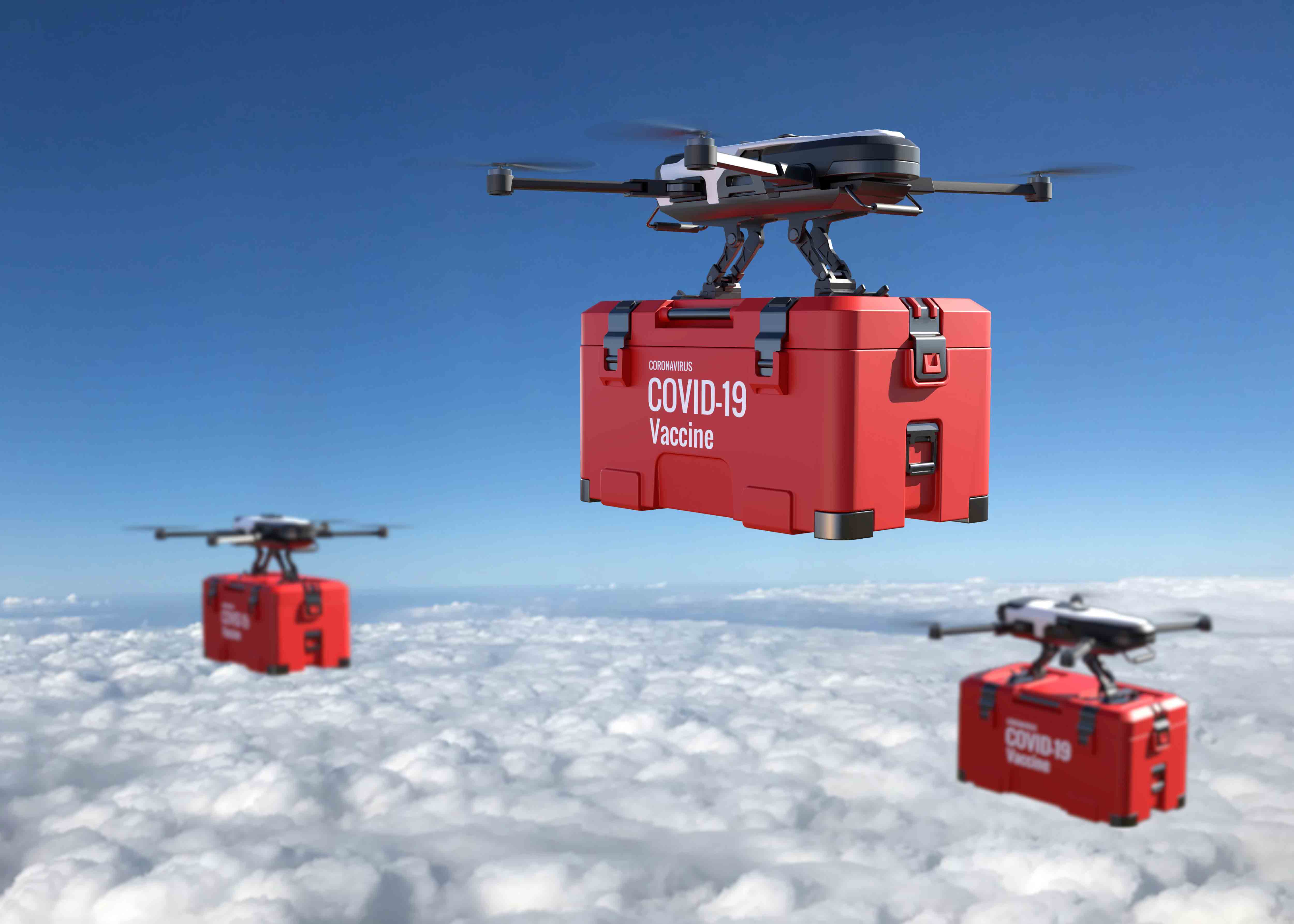
Drones are revolutionising healthcare and we are right there to provide top notch services and serving our people.
Our advanced platforms are ideal for providing Emergency Response, Rescue & Relief services to people in disaster-prone areas.
Helps you reach critical care, food, medicines and other medical supplies to areas that are otherwise remote and inaccessible.
Land Surveys & Geo-Spatial Mapping
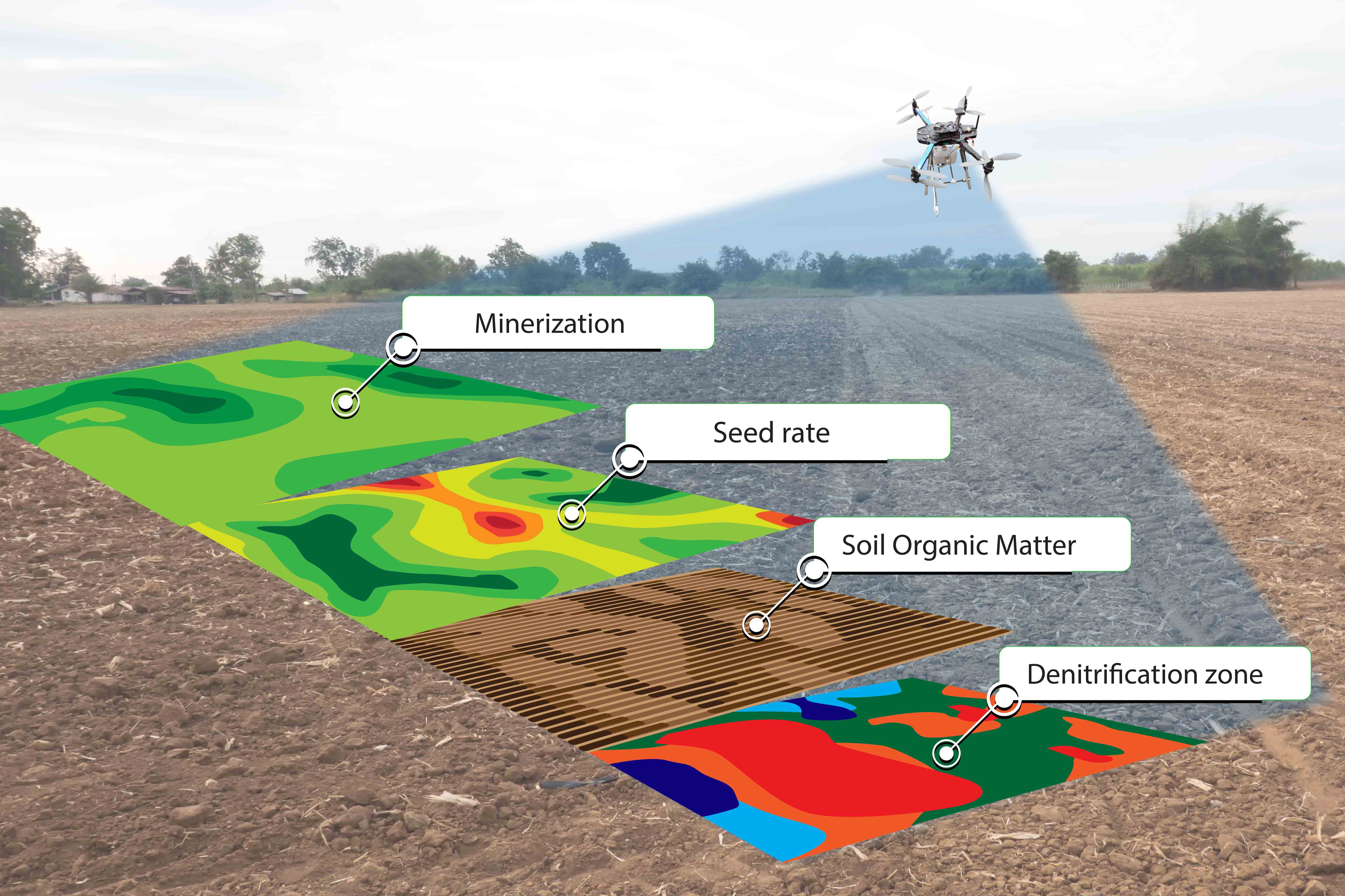
Our state of the art UAVs help you in surveying and Geo-spatial mapping for Land planning, Development & Management.
Equipped with multispectral sensors, LIDAR payloads, Thermal Imaging capabilities. It helps capture vast amounts of data and generate high resolution, highly accurate surveys and maps within a fraction of time and costs than the Conventional methods.
The UAVs with their heavylift, vertical take off and landing capabilities and endurance capabilities makes it possible for our customers to operate anywhere and everywhere regardless of the terrain, location and distance.
It makes accessible the most distant and inaccessible terrains across geographies and landscapes.
Railways
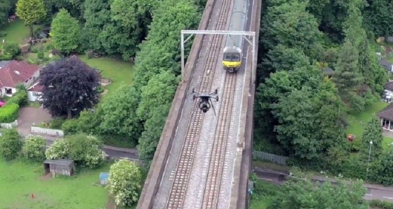
UAVs help us to prepare contour maps for proposed new railway lines, GIS data to calculate the length of tracks laid, monitor bridges, periodic assessments of railway assets,inspect hard to reach areas, inspect corrosion, cracks and fractures in tracks and also can be used in Emergency Response during natural or other disasters and calamities.
Also used in Emergency Response during natural or other disasters and calamities.UAVs make these tasks much more simpler, efficient and safe.
Stockpile Inspection
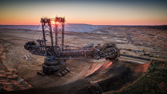
It is difficult to monitor large stockpiles manually because their volume changes as they are constantly moved. Also, it can be dangerous, time-consuming, and expensive to assign your workforce for stockpile inspection. Moreover, it is difficult to accurately estimate the volumes of large stockpiles using traditional methods.
Drones survey and assist in stockpile inspection by providing accurate data with thermal imaging for better clarity of the stockpile. We provide solutions for land survey inspections in such a way that the drone covers all areas. Also, we provide surveys with accurate high resolution images.
Oil & Gas pipeline Inspection
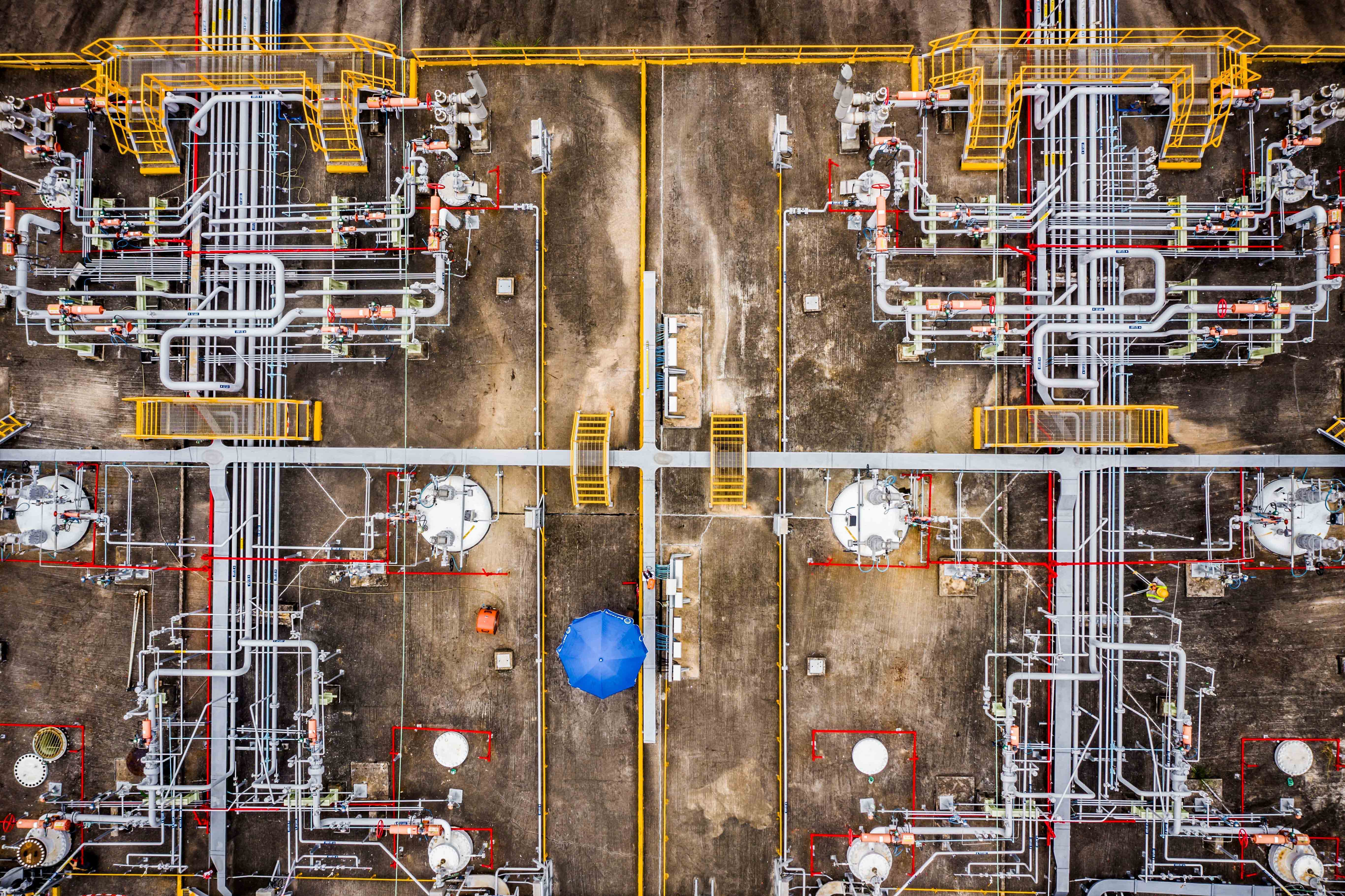
Oil and gas facilities must be inspected and maintained regularly to ensure safety and avoid failure of operations. Traditional inspection procedures require shutting down of the operations, constructing or using rope lines, and delivering an inspector into hazardous or areas that are difficult to access.
This is where drones come in handy. Drones can aid in conducting faster surveys, inspecting, and tracking extraction volumes daily. Additionally, it can reduce labor costs and improve operational efficiency. Our drones can eliminate the risks associated with manual inspections.
Magic Myna drones provide solutions that enable a better understanding of the pipeline network.
Powerline Stringing
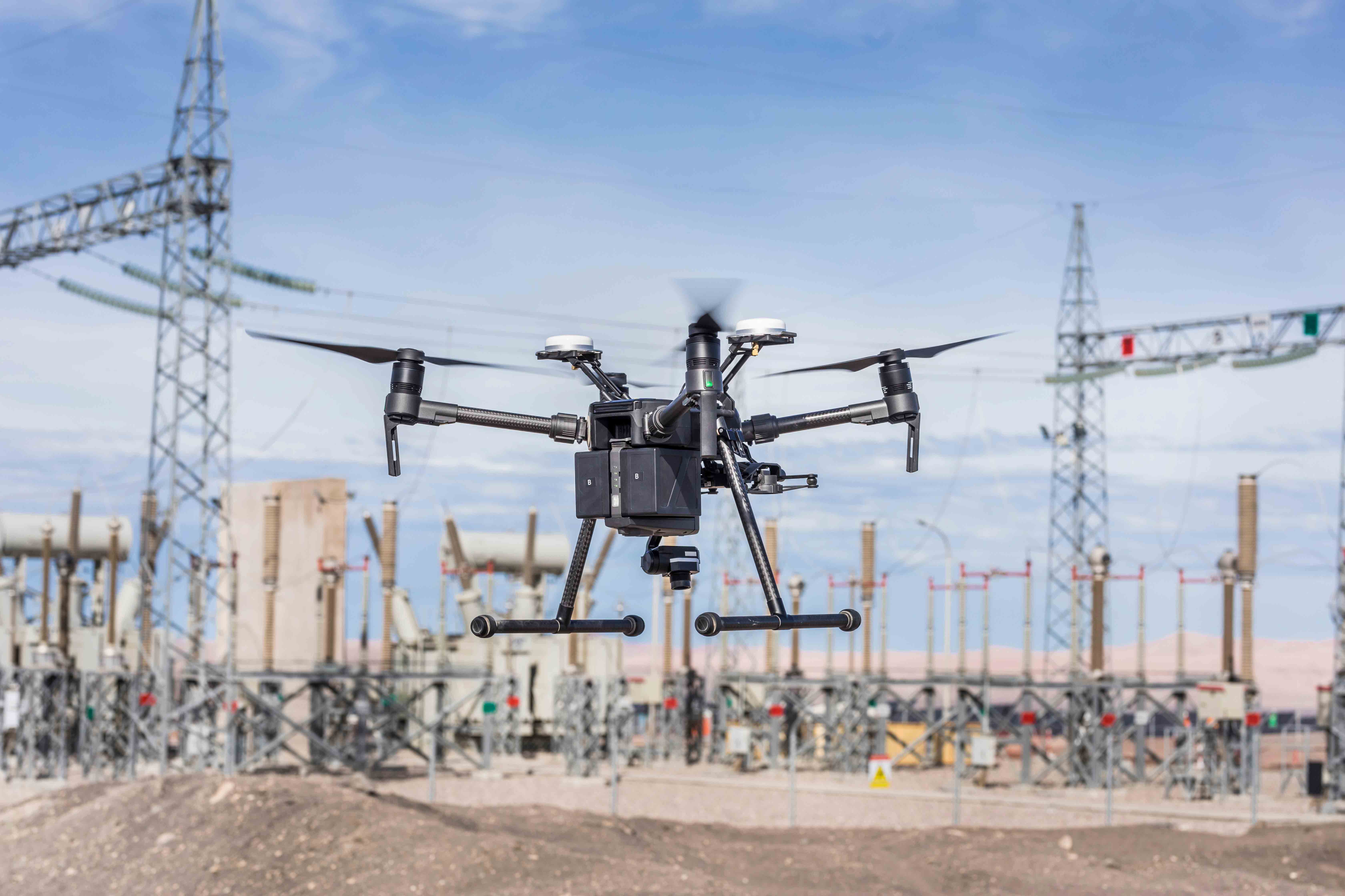
Powerline stringing - connecting the power transmission towers- is a challenging and time consuming task, as these lines cut across the length and breadth of various geographies, spanning several hundreds of kilometres. In the conventional method, a large number of men are deployed for several days to carry out the activity. Helps achieve massive costs and time savings.
Our high endurance platforms help you complete the tasks across different terrains like hilly regions, forest tracts, river crossings, railways lines, highways with minimum dislocation.
Help you complete the task with minimum manpower, minimum down time. Eliminates risks and protects workers health & safety.
Windmill Inspection
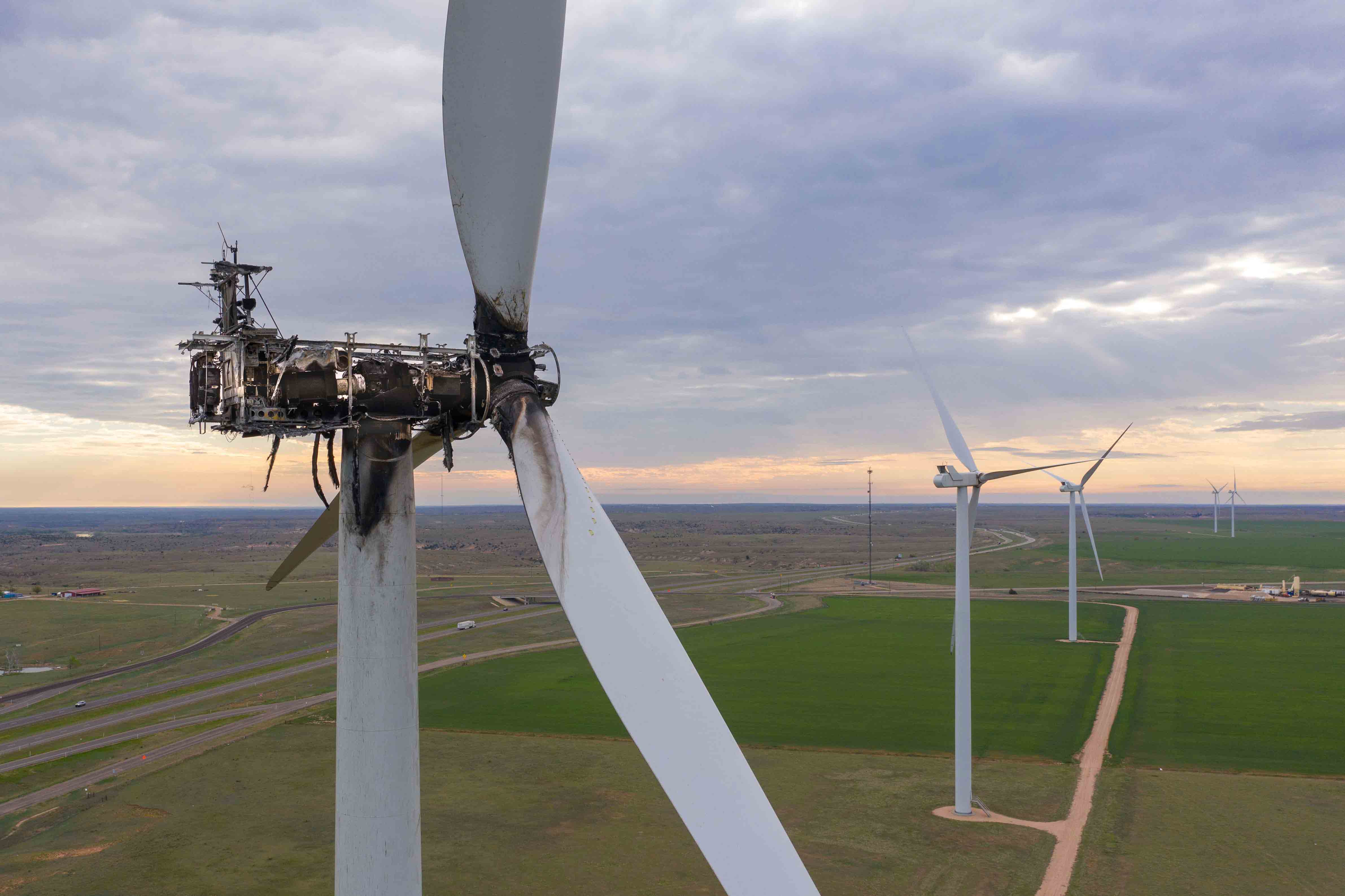
If the wind farms and mills have to perform at their optimum levels,it's important that any structural defects in the wind farm assets as well as the blades of the windmills are detected and rectified in a timely manner. But windmills and other assets are quite tall structures, visually examining them is a huge challenge.
Our platforms help resolve this problem quite easily. Equipped with multiple sensors, thermal and infrared imaging capabilities, they provide fine scale visual inspection of windmill structures and turbine blades and help detect the minutest defects in them.


